GIS tools for water supply systems: an implementation using JGrassTools and gvSIG
In the last years an increasing attention has been dedicated to the environmental protection and in particular to the preservation of the water resources. Accordingly to climate scenarios in less than 100 years the distribution of rainfall will change and an increase in floods is therefore expected but also in droughts. To mitigate negative consequences of future city growth and predicted climate changes, more effective water governance is needed.
Water governance can be effective if it is based on real measurable indicators and effective initiatives by adopting the idea of smart cities, taking advantage of the opportunities offered by information and communication technologies and the open data strategies. One example in the field of water distribution systems is use of hydraulics modeling to help public administrations or private companies for the optimization of the management, the monitoring of the water losses along the network and the management of the emergencies of the aqueducts.
In the last ten year GIS experienced a wide diffusion due to their usability, the increasing availability of geospatial data and software, in particular Open Source GIS like gvSIG. On the other hand JGrassTools is a powerful, scientific and relatively new project with mature roots derived from models developed within research projects in collaboration with the universities of Engineering of Trento and Sciences and Technologies of Bolzano (Italy).
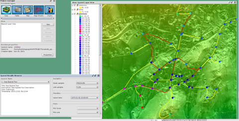
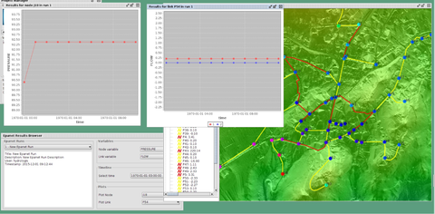
The plugin for network distribution systems in gvSIG uses the JGrassTools and supplies an userfriendly GUI with GIS functionalities for the preparation of data, the execution of the model, the visualization and query of simulations results. Data preparation is made easier using GIS integrated tools. Simulations results, distributed in space and time, are accessible using the GIS.
Such a tool can be used by professionals and public administrations to design and verify water supply systems (of drinking water but also of agricultural aqueducts), to optimize the management by the identification and localization water losses along the network and for the management of the emergencies of the aqueducts.


