
gvSIG and extDMSAR for Data Mining

There are large volumes of geographic data stored in geographic databases. But the organization of the data and the existing tools usually manipulate only explicitly stored data. They can't extract implicit knowledge. So, it is essential to develop new technologies for extracting that kind of knowledge (spatial relationships, other non-explicit patterns...) because data mining is very important to make decisions.
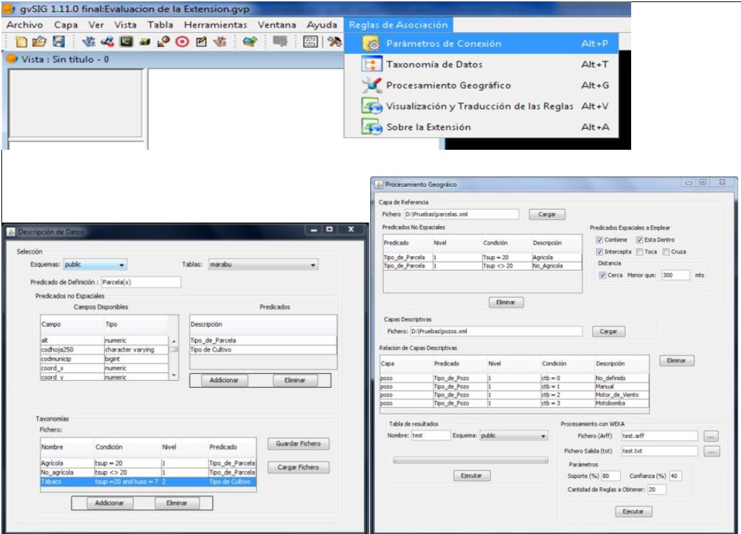
A new extension has been developed to extract implicit knowledge from geographic databases by using spatial association rules. This extension enables:
- to translate from the result of the application of a spatial association rule into natural language. The following sentence is an example of translated rule: 71% of the parcels that are near "Tipo de Pozo" (wind) and "Tipo de Pozo" (Pump) are farming plots.
- the geospatial display of the knowledge extracted on the map, that is to display the objects (eg. plots, soil and so on) that fulfil certain association rule in a map.
The use of this extension on gvSIG will not only enable to extract the implicit knowledge from the geographic information contained in a geospatial database but also represent and translate it into natural language by using an interface that any user, not only advanced users, can utilize.
Through traditional methods of information retrieval is not possible to extract the knowledge that exists in the database. But by using this extension the relationship between spatial and non spatial data of the topics that the user is analyzing can be discovered. Moreover, it's also possible to know to what extent some data influence each other and where they are located.
What is more, this extension enables to obtain a new map from the knowledge extracted.
Slides from the presentation given at the 3rd LAC gvSIG Conference