gvSIG for Archaeologists: Open source GIS for archaeological data processing, visualisation and analysis
To develop and document a methodology for the use of Open Source Software within surveying and figure creation, with particular reference to archaeological recording and dissemination: This was done as part of a large-scale road-building project, initially as a trial to test whether open source GIS could be employed for the maintenance, processing, querying and digitising of digital archaeological survey data, rather than the traditionally used legacy closed source GIS and CAD software. This approach had often been criticised and the move away from CAD declared problematic by fellow archaeologists.
To publicise the methodology as a manual, which would both guide the archaeologist though the steps of setting up their survey equipment and also explain to them the downloading of the data including an introduction to gvSIG, and to encourage it's adoption within other industries. In turn this would lead to refinement of the process and more cost effective training methods.
- Successful establishment of a project on site, initially using gvSIG OADE 1.0.1, but when it became available in November 2009 in gvSIG OADE 1.10
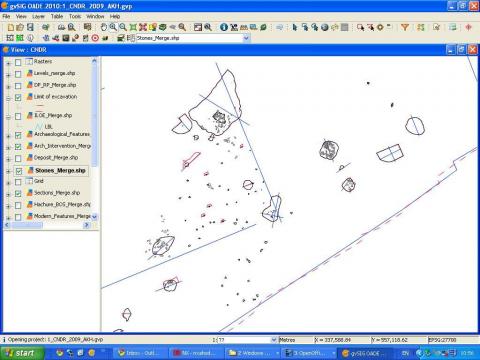
- gvSIG used on a daily basis to import the downloaded survey data, to print maps (occasionally refined in Inkscape), made database queries and georeferenced images, both hand-drawn site plans and hi-view photographs. Some initial digitising was also undertaken (this usually being part of the post-excavation process)
- The work-flow was documented in detail and released as an online and downloadable manual. This is turn was tested on site and refined on by using it as training material for staff.
- Other software used:
- Leica GeoOffice (downloading of raw survey data and export to shapefiles)
- Inkscape (for refining of printable maps)
- The above procedures resulted in a work-flow manual for archaeologists, describing each step from setting up the Total Station or GPS (Leica 1200 series), over the downloading of the survey data, to inputting the data into GIS software, digitising and producing of printable plans.
- This manual has proven useful and successful, not only within commercial archaeology, but has also been known to be of use, for instance in university teaching.
- The workflow has been extended further to include additional cartographic techniques that can be adopted in QGIS and InkScape, a powerful demonstrator of the potentials of Open Source Software and of Open methodologies.
- http://openarchaeology.net/project/survey-and-gis-manual
- gvSIG OADigital Edition: http://oadigital.net/software/gvsigoade
- On the Oxford Archaeology Library:
- Survey and GIS Manual: http://library.thehumanjourney.net/367/
- GIS to Inkscape Manual (adaptable for gvSIG) http://library.thehumanjourney.net/366/

