Skip directly to content

gvSIG Mobile


gvSIG and the Bétera City Council Planning Department

Georeferenciación de planos
Visualización de información puntual
Situation: 

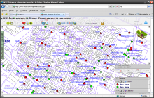
The Bétera City Council Planning Department creates the Bétera Geographic Information System which purpose is the collection, analysis, maintenance and distribution of municipal information likely to be georeferenced, either alphanumeric or graphic. The main idea is achieve interoperability between public administrations and departments within the municipality located in different buildings and through mobile units.

Software: 
0
No votes yet
Country: 

gvSIG for managing roads information

Sectors: 
Situation: 

The main objective was to offer the geographical information available and develop a GIS for managing roads information.

Software: 
5
Average: 5 (2 votes)
Country: 

Pages