Skip directly to content

Infrastructures

Implantación del aplicativo gisEIEL en el Consell Insular de Mallorca

Situation: 

Necesidad de implantación de un software para la gestión integral de la EIEL de Mallorca.

Software: 
5
Average: 5 (1 vote)
Country: 

Georeferenced Managed Objects and InfraWorld

Situation: 

The Norwegian Research Council's project InfraWorld addresses R&D on next generation geographic information management, by studying and implementing concepts of georeferenced managed objects (GMO). The goal is to define, publish and exchange geo-related content as objects so that non-specialists on one hand can explore the content and interact with it, on the other hand specialists can create and instantly use new data models using the same solution.

Software: 
0
No votes yet
Country: 

Building business applications above gvSIG: a case study with a bus network management GIS for the Algerian Transport Ministry

Situation: 

This application has been developed by Alkante for the Algerian Transport Ministry under the supervision of the Belgian consulting cabinet Transurb. It aims at helping city bus network managers to structure and optimize their network. As the network managers are not GIS experts at all, the application is to be user-friendly and should allow people :

  • to draw and to update the different components of their network (bus lines, bus stops) using an existing base layer (for example with snapping on a road network),

  • to run spatial analyses of their network in order to quantify the impact of

Software: 
5
Average: 5 (2 votes)
Country: 

Aplicación sobre gvSIG para la consulta y visualización de mapas de caudales máximos

Situation: 

El principal objetivo de la aplicación de caudales máximos (CauMax) es ofrecer una herramienta que ayude a:

  • Consulta de los mapas de caudales máximos para los periodos de retorno de 2, 5, 10, 25, 100 y 500 años.
  • Cálculo del caudal máximo de cualquier otro periodo de retorno entre 2 y 500 años por interpolación de los valores de los mapas ya definidos previamente.
  • Proporcionar una herramienta para realizar estimaciones de los caudales máximos en los puntos de la red fluvial no incluidos en los mapas (cuencas menores de 50 km2).
     
Software: 
4.333335
Average: 4.3 (3 votes)
Country: 

Sistema Integral para la Gestión de una Autopista basado en gvSIG. SIGA, propuesta de desarrollo en AUDASA

Sectors: 
Situation: 

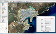
Los Sistemas de Información Geográfica constituyen una herramienta de primer orden para la análisis y gestión del territorio así como la práctica del urbanismo, pero también para la gestión de una gran infraestructura lineal como es el caso de la Autopista del Atlántico. Esta obra vertebra el principal motor económico del noroeste peninsular: el Eje Atlántico, con ciudades como Ferrol, A Coruña, Santiago de Compostela, Pontevedra o Vigo.

Software: 
5
Average: 5 (6 votes)
Country: 

Pages