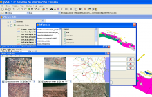
There was a GIS developed using MapObjects that supported shape and dxf data formats. It was necessary to migrate to a free GIS and develop more functionalities:
- Development of a GIS to manage geoinformation related to the Valencian coast
- Use of a spatial database and access to it through OGC services
- Development of not georeferred image analysis tools