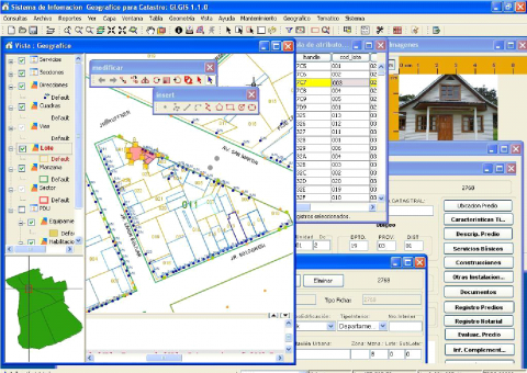
gvSIG for the management of municipal cadastre
Contact name:
Marino Carhuapoma
Organization:
IdeasG
Sectors:
Software:
Situation:
Having a geographic information system for urban cadastre where they will demonstrate significant savings in software licensing costs, based on spatial database.
Solution:
Implement the solution in the municipality with gvSIG as a GIS platform base and customize gvSIG , so it can be a gis system with the requirements of cadastre as spatial database and other capabilities.
Benefits:
- Automate regular activities of urban cadastre
- Maintain cadastral information easily
- Automates the migration of CAD data to the structure of spatial database
- Manage user authentication and security at the database and application
- Generate thematic maps of many urban variables in a single click
- Generate comprehensive reports for different areas of the municipality
Links:
Rate it!!:

