
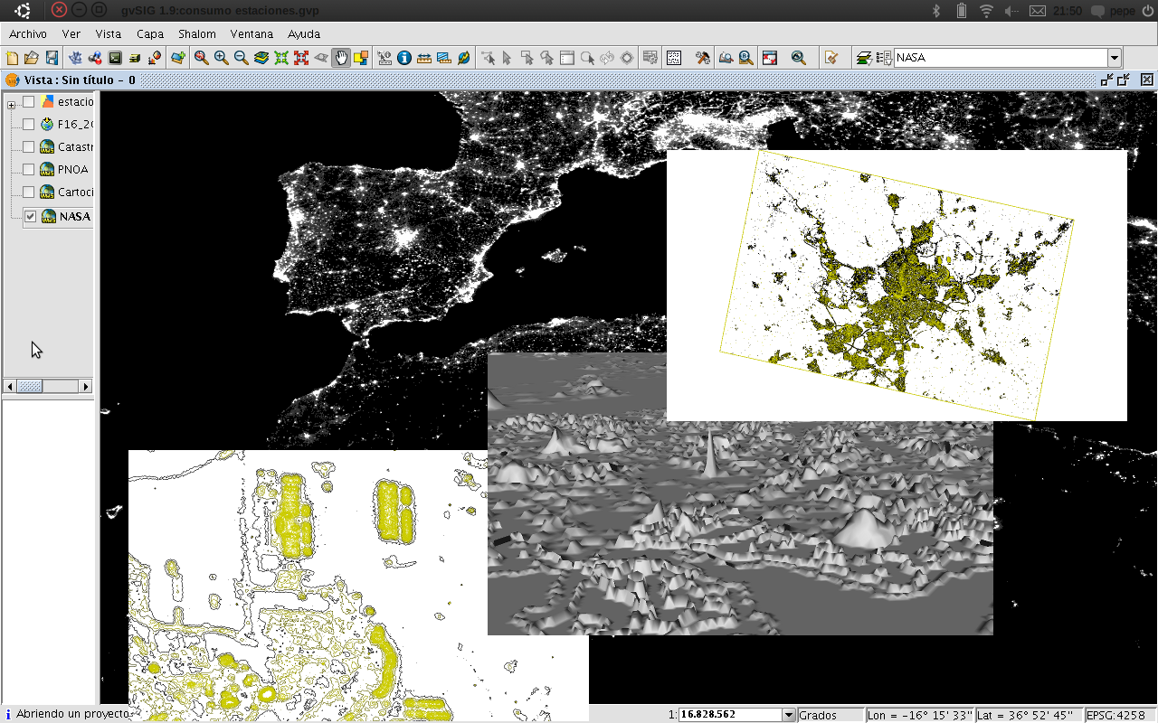
Using gvSIG to compute light pollution from night satellite images
Light pollution (introduced by humans, directly or indirectly, from artificial light into the environment) is a major issue worldwide, particularly in urban areas. It increases the sky glow and prevents us from observing a dark starry sky. There is also a direct relationship between light pollution and electric consumption.
The night pictures taken from the International Space Station (ISS) and other NASA missions as DMSP can be used to compute light emission from ground based locations. We need a complete GIS toolkit to study correlations among the satellite images and light sources. So we can get information about individual buildings or geographical areas. We need also a tool which can use standard OGC services to access Geographic information and Layers from other SDI (Spatial Data Infrastructure), as IDEE. The connection to spatial databases, as PostGIS, would be the last requirement.
- gvSIG as desktop GIS
- Georreference of raster satellites images
- WMS and WFS client configuration
- PostGIS client configuration for metadata integration
- Vectorial layers generation
- DEM generation
- Integration with Sextante and 3D extensions
- Layer generation for Geoserver deployment and WMS publication
- Improvement of the decision making processing taking into account different types of georeferenced information
- Easy access to different data sources
- Easy process to georreference images
- Easy identification of ground sources using official cartography
- Possibility to generate DEM and 3D models to recognize ground sources and show them to general public