Skip directly to content

Italy

Assessing urban accessibility in the city of Brescia: the impact of public transport infrastructures

Situation: 

Setting up a methodology for analysing the urban accessibility of Brescia referring to the available modes of transport. Understanding which are the more disadvantaged areas in terms of accessibility and available transport services. Identifying where new services should be located to lower the gap between different areas and reduce the car traffic inside the city. Evaluating the impact of new public transport infrastructures, such as tramways and subways.

Software: 
5
Average: 5 (2 votes)
Country: 

GIS open source framework for an interactive surface and groundwater modelling

Situation: 

The SID&GRID research project, started April 2010 and funded by Regione Toscana (Italy) under the POR FSE 2007-2013, aims to develop a Decision Support System (DSS) defined by a framework based on open source and public domain solutions for the planning and management of the water resource. Today, while some surface hydrological processes are embedded within GIS both commercial and open source, the groundwater modelling processes is not easy to find within geographical code and algorithm.

It will consist in watershed-scale model able to simulate surface and subsurface flow in a

Software: 
5
Average: 5 (3 votes)
Country: 

Asbestos extension: an advanced customization of NavTable that provides an assisted data entering for the asbestos surfaces status of the Autonomous Province of Trento

Situation: 

Ultimate goal of the “Dati Amianto” project is to enable the APSS (Azienda Provinciale per Servizi Sanitari) of Trento for the gathering of the data coming from the in-place examination of the status of asbestos surfaces (identified via MIVIS scanning) of the provincial territory.

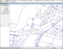
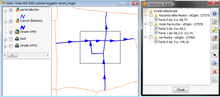
The surfaces to analyse and their attributes are contained within a single shapefile (APSS sheet), logically divided into smaller parts and sent to every in-charge person.

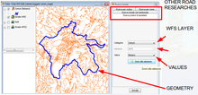
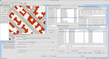
The developed extension is thus required to provide a suitable solution for the municipal technicians for the:

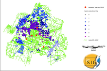
  • displaying of the data contained
Software: 
4.6
Average: 4.6 (5 votes)
Country: 

WG-Edit: a new gvSIG extension for the street cadastre management

Situation: 
  • ArcView 3 is no more supported by ESRI
  • WgEDIT extension for ArcView3 is no longer supported
  • Avenue is an old language (it is difficult to implement new customizations)
  • The basic road network and the attributes of the roads are currently managed by two different technologies
Software: 
5
Average: 5 (4 votes)
Country: 

iter.GIS – Desktop based application to manage toponymy data among Tuscany Region

Situation: 

Regione Toscana founded a regional project named iter.net (http://www.iternet.fi.eng.it/SigmaPortal2) to set up a communication infrastructure that allows toponymy data transfer from Local Entities to Regione Toscana itself, using regional transfer infrastructure known as CART (http://www.cart.rete.toscana.it).

As a strategic component of such a design, Regione Toscana needed an application to enable Local Entities to manage road network and street numbers and to transfer updates through CART.

Software: 
0
No votes yet
Country: 

Pages