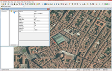
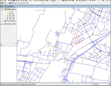
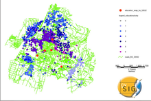
Skip directly to content

gvSIG Desktop

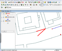
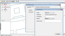
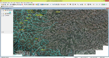
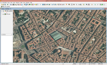
gvSIG is a Geographic Information System (GIS) desktop application designed for capturing, storing, handling, analysing and deploying any kind of referenced geographic information in order to solve complex management and planning problems. gvSIG is known for its user-friendly interface and being able to access all common vector and raster formats. It features a wide range of tools for working with geographic information (query, layout creation, geoprocessing, networks, etc.), which turns gvSIG into the ideal tool for users working in the land realm.

Extensión As-built. Herramienta para el inventario de infraestructuras urbanas lineales y trazabilidad de elementos de red

Situation: 

Implementar un procedimiento que permita geoposicionar con exactitud toda la red de gas en el momento que se está construyendo identificando todos los elementos, afectaciones y protecciones basado en tecnologías libres y abiertas, que garantice la interoperabilidad de los datos para que puedan ser consultados con eficacia.

Actualmente se realizan croquis en papel de la instalación ejecutada y se toman medidas situando los diferentes elementos de red sobre la cartografía de base. Posteriormente estos croquis se informatizan y se acotan los diferentes elementos en oficina sobre tecnologías CAD.

Software: 
0
No votes yet
Country: 

Environmental and turistic recovery of the abandoned villages of Abruzzo parks

Situation: 

Create a hiking trail that connects the abandoned villages in the Teramo province located inside the National Park of Gran Sasso and Monti della Laga (the largest by extension all over Italy)

Software: 
5
Average: 5 (2 votes)
Country: 

Analysis of the value chain for leather products in San Lorenzo street market

Sectors: 
Situation: 

A research about leather shops (an important business for the city of Florence) in the San Lorenzo Market, in the historic centre of Florence. Two main topics have to be analysed: working conditions, since most of shop employees are without regular contract and/or underpaid, the lack of protection policies for the worldwide well known “Made in Italy”.

Software: 
5
Average: 5 (1 vote)
Country: 

Assessing urban accessibility in the city of Brescia: the impact of public transport infrastructures

Situation: 

Setting up a methodology for analysing the urban accessibility of Brescia referring to the available modes of transport. Understanding which are the more disadvantaged areas in terms of accessibility and available transport services. Identifying where new services should be located to lower the gap between different areas and reduce the car traffic inside the city. Evaluating the impact of new public transport infrastructures, such as tramways and subways.

Software: 
5
Average: 5 (2 votes)
Country: 

International diffusion of gvSIG through training activities

Situation: 

The development of an open source software is strictly to its diffusion worldwide and to the number of active users that works in testing activities and feeding mailing lists. International consultants, as well as local technicians, working in the framework of projects in developing countries have often raised the problem of lack in knowledge and skill for collect, store and analyse geographical data in several fields such as environment, health and socio-economic sectors.

Software: 
5
Average: 5 (2 votes)
Country: 

Pages