Skip directly to content

gvSIG Desktop

gvSIG is a Geographic Information System (GIS) desktop application designed for capturing, storing, handling, analysing and deploying any kind of referenced geographic information in order to solve complex management and planning problems. gvSIG is known for its user-friendly interface and being able to access all common vector and raster formats. It features a wide range of tools for working with geographic information (query, layout creation, geoprocessing, networks, etc.), which turns gvSIG into the ideal tool for users working in the land realm.

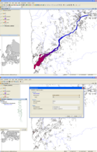
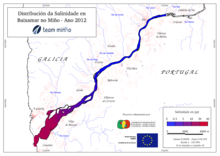
Analisys of contaminants and salinity in the Minho's river for the European Project

Situation: 

The project TEAM-Minho, led by the University of Vigo, brings together scientific partners and water administrations on both sides of the river Minho to develop common tools for the coordinated implementation of the Water Framework Directive in its estuary.The aim of this project is the establishment of uniform scientific criteria, valid for Spain and Portugal, allowing the definition, referencing and classification of ecological status of transitional water bodies in southern Galicia and northern Portugal.

Software: 
5
Average: 5 (6 votes)
Country: 

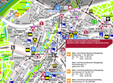
gvSIG as a GIS tool for creating maps for senior citizens published by the City of Munich

Situation: 

Senior citizens in cities are often less mobile than younger persons and therefore not participating in social activities or getting enough physical exercise.

In order to promote their health and their participation in social life, maps specifically tailored to the needs of the elderly can be a valuable contribution to complement other health care activities.

Software: 
5
Average: 5 (10 votes)
Country: 

Administración de Servicios de Salud del Estado (ASSE) - Uruguay

Sectors: 
Situation: 

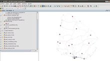
ASSE necesitaba tanto para la gestión como para lo operativo realizar análisis espacial tanto de los recursos como de los servicios, sin olvidar todo lo epidemiológico y los distintos eventos que se puedan presentar en el área de la Salud.

La organización contaba con software privativo, lo que generaba entre otras dificultades una erogación presupuestal alta, contínuo licenciamiento y costos elevados en dichas licencias. Fue necesrio bajar costos en este sentido.

También se analizó que la curva de aprendizaje se suaviza a medida que se trabaja con GVSIG, entonces se instala en la

Software: 
0
No votes yet
Country: 

gvSIG aplicado al estudio de yacimientos de icnitas de dinosaurios

Situation: 

Las icnitas son uno de los fósiles indirectos más conocidos de los dinosaurios y España es un lugar privilegiado por la abundancia de este tipo de fósiles. Estos restos tienen un importante valor desde el punto de vista científico ya que de su estudio se extrae información relevante sobre los actos vitales (comportamiento) y el entorno (paleohábitat) de estos grandes animales. Además, destaca su valor patrimonial, debido al reciente incremento del interés por la geodiversidad y el geoturismo.

En este contexto surge la necesidad de disponer de una metodología y de herramientas adecuadas para

Software: 
0
No votes yet
Country: 

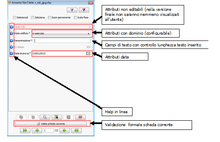
Asbestos extension: an advanced customization of NavTable that provides an assisted data entering for the asbestos surfaces status of the Autonomous Province of Trento

Situation: 

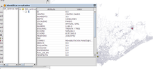
Ultimate goal of the “Dati Amianto” project is to enable the APSS (Azienda Provinciale per Servizi Sanitari) of Trento for the gathering of the data coming from the in-place examination of the status of asbestos surfaces (identified via MIVIS scanning) of the provincial territory.

The surfaces to analyse and their attributes are contained within a single shapefile (APSS sheet), logically divided into smaller parts and sent to every in-charge person.

The developed extension is thus required to provide a suitable solution for the municipal technicians for the:

  • displaying of the data contained
Software: 
4.6
Average: 4.6 (5 votes)
Country: 

Pages