Skip directly to content

gvSIG Desktop

gvSIG is a Geographic Information System (GIS) desktop application designed for capturing, storing, handling, analysing and deploying any kind of referenced geographic information in order to solve complex management and planning problems. gvSIG is known for its user-friendly interface and being able to access all common vector and raster formats. It features a wide range of tools for working with geographic information (query, layout creation, geoprocessing, networks, etc.), which turns gvSIG into the ideal tool for users working in the land realm.

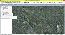
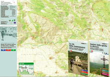
Routes of Transhumance and historics paths in Abruzzo (Italy)

Situation: 

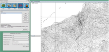
This work involved in the project of interregional and international cooperation "Routes and Civilization of Transhumance World Heritage" and foresees actions to value the ancient sheep tracks and other roads of historical value.

The project aims is to apprise the value of the the landscape, the typical products, crafts and heritage and architectual, in order to promote tourism and culture in the context in which they are situated.

Software: 
5
Average: 5 (2 votes)
Country: 

Cuevas Santuario en la Costa Este de Yucatán

Situation: 

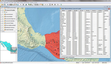
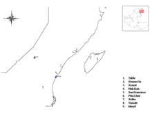
Αl ser ésta una zona principalmente caliza, dentro del ámbito geográfico de Yucatán las cuevas y demás formaciones naturales producidas por la disolución kárstica son un tópico paisajístico tremendamente frecuente. Como espacios que albergan diferentes tipos de recursos aprovechables, el Ser Humano comenzó a explotarlos desde tiempos realmente antiguos. Durante los casi 2000 años de poblamiento maya prehispánico en esta zona, el empleo y la ocupación de estos singulares espacios se dispara.

Sin embargo, aunque de forma menos frecuente de lo que se cree, estas cavidades son usadas con fines

Software: 
0
No votes yet
Country: 

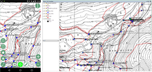
Digital field mapping with Geopaparazzi and gvSIG

Situation: 

Geopaparazzi is an application for fast field surveys. Its simplicity and the possibility to use it on as good as any android smartphone makes it a trusty field companion for engineers and geologists, but also for tourists who wish to keep a geodiary and any user that needs to be aware of his position even in offline mode.

In Geopaparazzi it is possible to create text, picture and sketch notes and place them on the map. Notes can also be complex and form based in order to standardize surveys in which many people need to be coordinated.

The data collected in the field can be exported as KMZ or

Software: 
5
Average: 5 (4 votes)
Country: 

Caracterización de la infraestructura del Sistema de Perín, de la Carthagena Water & Mining Co. Ltd

Sectors: 
Situation: 

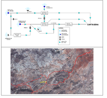
No se ha encontrado en los Archivos información completa de la infraestructura del Sistema de Perín, por lo que se han tomado los datos in situ, a través de entrevistas con los vecinos que recordaban por dónde estaban las diferentes tuberías, depósitos, etc. Se han tomado los datos con receptores GPS.

Software: 
5
Average: 5 (2 votes)
Country: 

Utilización de gvSIG para determinar zonas potenciales de erosión de suelos

Situation: 

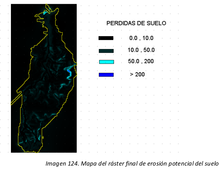
La pérdida de suelo y erosión son problemas endémicos que se están viendo acentuados en el contexto actual de cambio climático, con especial afección en todo el arco mediterráneo. Es por tanto necesario, establecer medidas de conservación de suelos que ayuden a mitigar y corregir dicho problemas de pérdida de suelo para que el suelo, recurso no renovable a escala humana, no sufra, en la medida de los posible, los deterioros y problemas ambientales que le afectan en la actualidad.

Software: 
5
Average: 5 (2 votes)
Country: 

Pages