Skip directly to content

Navtable

gvSIG-­Fonsagua, planificación y diseño de sistemas de abastecimiento basado en tecnologías para el desarrollo humano (TpDH)

Situation: 

En el marco de esta iniciativa se diseña una herramienta capaz de implementar sobre un Sistema de Información Geográfica la metodología vinculada al Plan de Gestión Integral del Recurso Hídrico empleada por ingeniería sin fronteras en varios países de Centroamérica.

El PGIRH conforma un instrumento de diagnóstico de la situación de acceso al agua y el saneamiento basado en la defensa del recurso hídrico y en el fortalecimiento de las estructuras de acción ciudadana articuladas en torno al derecho al agua.

  1. Levantamiento de la información.
Software: 
0
No votes yet

GIS applications in forest and urban environment in East Africa

Situation: 

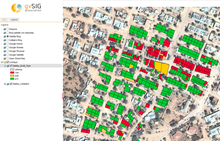
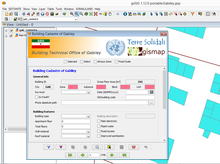
Collect, store, edit and publish the collected field data in a WebGIS, easy-to-manage and update in order to share all the achieved results as a very important tool in developing countries.

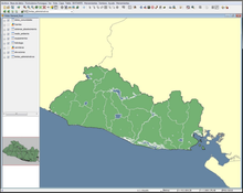
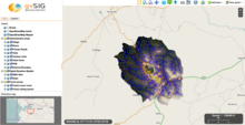
GISMAP has supported two projects for development cooperation, one in Kenya and another one in Somaliland.

In both cases, available environmental and urban information were not updated, collected in a not well structured method and stored in paper format without any possibility of geographic analysis and update.

Local technicians had poor computer skill and there was no possibility of sharing important data

Software: 
5
Average: 5 (1 vote)
Country: 

gvSIG applications in East Africa – Kenya and Somaliland

Situation: 

The availability of well structured geographic data together with the possibility of a regular updating, represent a very important tool worldwide and in particular in developing countries.

Somaliland local government is trying to develop a policy of transfer of knowledge in different sector and, among these, the capacity of urban management and planning. In this framework, GISMAP has supported the Italian ONG Terre Solidali, to train the Gabiley Municipality technical staff and make them able to produce precision “cadastral” maps of buildings together with a socio-economic survey.

Kenya

Software: 
5
Average: 5 (7 votes)
Country: 

Implementación de gvSIG al SIG del ayuntamiento de Sant Sadurní d'Anoia

Situation: 

El ayuntamiento de Sant Sadurní d'Anoia empezó a utilizar las herramientas de SIG para gestionar toda la información territorial desde el año 2004.

El programa de SIG que utilizaban en Servicios Técnicos se llamaba GeoVisor, programa desarrollado por GeoData que se caracteriza por ser sencillo de utilizar, potente en consulta y amigable. El GeoVisor estaba desarrollado haciendo uso de un componente OCX llamado MapObject que la empresa ESRI comercializaba. Con la aparición del programa ArcGIS ESRI dejó de comercializar dicha librería.

A partir del 2008 se desarrolló un servidor de mapas con

Software: 
4
Average: 4 (5 votes)
Country: 

Asbestos extension: an advanced customization of NavTable that provides an assisted data entering for the asbestos surfaces status of the Autonomous Province of Trento

Situation: 

Ultimate goal of the “Dati Amianto” project is to enable the APSS (Azienda Provinciale per Servizi Sanitari) of Trento for the gathering of the data coming from the in-place examination of the status of asbestos surfaces (identified via MIVIS scanning) of the provincial territory.

The surfaces to analyse and their attributes are contained within a single shapefile (APSS sheet), logically divided into smaller parts and sent to every in-charge person.

The developed extension is thus required to provide a suitable solution for the municipal technicians for the:

  • displaying of the data contained
Software: 
4.6
Average: 4.6 (5 votes)
Country: 

Pages