Skip directly to content

Sextante

gvSIG y SIGAP para Análisis Prospectivo

Situation: 

En el área de investigación de Análisis Prospectivo se presenta la necesidad de contar con una herramienta de apoyo para la definición informática de los modelos prospectivos y para su ejecución. Esto es especialmente necesario cuando los modelos tienen muchos factores y cuando se quieren correr para realizar análisis territoriales.

Software: 
0
No votes yet
Country: 

gvSIG aplicado a la explotación de infraestructuras y servicios urbanos. Abastecimiento de agua potable, saneamiento, vialidad, alumbrado público, espacios verdes, residuos y equipamientos

Situation: 

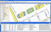
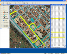
Las necesidades iniciales eran la de crear una herramienta para facilitar la explotación y mantenimiento de todo tipo de infraestructuras urbanas, y en especial las de abastecimiento, saneamiento, alumbrado público, espacios verdes, elementos de la vialidad, recogida de residuos, limpieza viaria y equipamientos.
Había que ir mas allá del inventario de elementos y poder sacar el máximo partido a la herramienta para explotación de las infraestructuras, cada una de ellas en la medida de sus posibilidades de gestión y emulando las funciones de programas existentes en el mercado actualmente.

Software: 
5
Average: 5 (7 votes)
Country: 

gvSIG aplicado a viticultura

Situation: 

Software gratuito para impartir cursos de SIG aplicado a la viticultura y para su implantación en bodegas para gestión de campo.

Software: 
4
Average: 4 (1 vote)
Country: 

Using gvSIG to compute light pollution from night satellite images

Situation: 

The night pictures taken from the International Space Station (ISS) and other NASA missions as DMSP can be used to compute light emission from ground based locations. We need a complete GIS toolkit to study correlations among the satellite images and light sources. So we can get information about individual buildings or geographical areas.
We need also a tool which can use standard OGC services to access Geographic information and Layers from other SDI (Spatial Data Infrastructure), as IDEE. The connection to spatial databases, as PostGIS, would be the last requirement.

Software: 
5
Average: 5 (4 votes)
Country: 

gvSIG for modeling the Holocene landscape

Situation: 

Our intention was to model the landscapes of the past from data of the present. To achive this we had geomorphological and archaeological field data spanning more than 20 years of work.

Software: 
0
No votes yet
Country: 

Pages