Skip directly to content

gvSIG Desktop

gvSIG is a Geographic Information System (GIS) desktop application designed for capturing, storing, handling, analysing and deploying any kind of referenced geographic information in order to solve complex management and planning problems. gvSIG is known for its user-friendly interface and being able to access all common vector and raster formats. It features a wide range of tools for working with geographic information (query, layout creation, geoprocessing, networks, etc.), which turns gvSIG into the ideal tool for users working in the land realm.

gvSIG for modeling the Holocene landscape

Situation: 

Our intention was to model the landscapes of the past from data of the present. To achive this we had geomorphological and archaeological field data spanning more than 20 years of work.

Software: 
0
No votes yet
Country: 

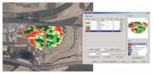
gvSIG applied to viticulture

Situation: 

A free software solution was needed to teach courses on GIS applied to viticulture and for free implementation on vineyards and wineries to manage wine production.

Software: 
0
No votes yet
Country: 

gvSIG for updating commercial establishment databases

Situation: 

For updating commercial establishment databases of the Comunitat Valenciana through the agencies for commercial innovation promotion (AFIC), people who managed surveys needed a support tool to take georeferenced data.

Software: 
4.25
Average: 4.3 (4 votes)
Country: 

gvSIG and the Bétera City Council Planning Department

Georeferenciación de planos
Visualización de información puntual
Situation: 

The Bétera City Council Planning Department creates the Bétera Geographic Information System which purpose is the collection, analysis, maintenance and distribution of municipal information likely to be georeferenced, either alphanumeric or graphic. The main idea is achieve interoperability between public administrations and departments within the municipality located in different buildings and through mobile units.

Software: 
0
No votes yet
Country: 

gvSIG and CarThema 5.0

Situation: 

Migration to Java code of a graphical application developed in Delfi suitable for releasing of thematic charts.

Software: 
0
No votes yet
Country: 

Pages